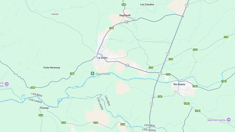
The Union is the capital of the Province of Ranco, in the south of the Region of Los Ríos of Chile, with about 39,447 inhabitants according to the last official census. It is located in the valley of the Bueno River, 40 km north of Osorno and 80 km south-east of Valdivia. Its position near Lake Ranco and surrounded by Cordilleras gives it privileged landscapes and a temperate rainy (ocean) climate, with rainfall distributed all year round. Thanks to this constant humidity the region maintains green meadows and fertile soils for agriculture and livestock: the maximum winter temperatures are between 6 ° C and 11 ° C, while in summer they can exceed 30 ° C
History

The current territory of La Unión was populated from before the arrival of the Spaniards by Mapuche-huilliche communities called “cudicans,” which controlled from the Llollelhue River to the Bueno River and which lived in communities organized by caciques (Anquiñir, Catriguala, Manquepán, among others). The prosperity of the area, including gold launchers, attracted colonial attention: in 1788 Ambrosio O’Higgins founded the mission and strong Our Lady of the Pilar to exploit its resources.
At the end of the 18th century, a regional indigenous uprising took place in September 1792, led by Queipul and Futañirre, in which the Spanish mission and fort were burned. This revolt and the consequent dispersion of the populations generated a space that, a few years later, favored Chilean expansion in the area. In 1795-1796 the Supreme Director Bernardo O’Higgins travelled through the area (towards Valdivia and back to Valparaiso) and proposed the foundation of an intermediate city between Osorno and Valdivia. In January 1796 he traced the Villa Alcudia by the river Bueno, but this population did not prosper.
With Chile’s independence, in 1821 the governor of Valdivia, Cayetano Letelier, asked the supreme director Bernardo O’Higgins to establish a town on the plain that was then called “El Llano” (between the Bueno and Traiguén rivers). Following administrative efforts, on 15 February 1827 the Provincial Assembly of Valdivia officially decreed the creation of the Free Villa of San Juan in the Llano de Negrón. (According to historian Osvaldo Leal, the people became known as San José de La Unión.) That was the formal origin of the town. However, due to local disputes the villa did not settle on the initial site planned and in 1843 the mayor José Ignacio García determined its final establishment between the Llollelhue and Radimadi rivers, in the place of the present city.
Finally, in 1890 the name La Unión was officially imposed, in reference to the encounter of its Llollelhue and Radimadi rivers to the south of the city. (Another interpretation of the name, of Mapuche origin, suggests that it comes from “daglipulli,” the word Mapudungun which means “union of spirits.”) Throughout the 19th century the area received German settlers: it remains a mark of this in the traditional architecture that still survives in the city. In 1851, the Prussian naturalist Rodolfo Amando Philippi, invited by his brother Bernardo Philippi, arrived at the San Juan Fundo, contributing to the scientific and cultural development of the commune.
Featured historical chronology:
- 1788: Governor Ambrosio O’Higgins bases the mission and strength of Our Lady of the Pilar in the area.
- 1792: Indigenous uprising of Queipul and Futañirre; Spanish mission and fort are destroyed.
- 1795-1796: O’Higgins walks through the region and traces the ephemeral Villa Alcudia on the banks of the river Bueno.
- 1821: A petition for the foundation of a people in “El Llano” by Cayetano Letelier, governor of Valdivia.
- 1827: Official Decree (Assembly of Valdivia) establishing the Free Villa of San Juan in the Llano de Negrón.
- 1843: The villa is definitely moved between the Llollelhue and Radimadi rivers (current location).
- 1890: The town takes the name of The Union, allusive to the confluence of their rivers.
Geography and climate
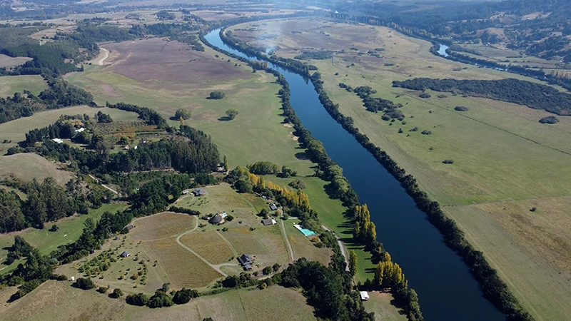
The city of La Unión is located in an extensive alluvional plan, between the Cordillera de la Costa and the Cordillera de los Andes, in the vicinity of the Bueno River and within walking distance of Lake Ranco. This location allows you to enjoy many natural areas: for example, the nearby house of Puerto Nuevo (about 45 km) and its beach on Lake Ranco, or the port of Trumao on the river Bueno, from where river walks are organized. Several tourists offer navigation circuits along the river Buena to its mouth, excursions to the Alerce Costero National Park (millennial alert forests) and tours of ancient coastal forests and German settlers’ heritage houses.
The local climate is rainy temperate (ocean climate), with moderate rainfall at high levels throughout the year. The presence of the Andean and coastal saws generates variations: the western sides of both massizos receive much rain, while the intermediate depression (where the city is) is somewhat drier. This constant humidity makes meadows and forests flourish: maximum winter temperatures range from 6 ° C to 11 ° C, and in summers the maximum can exceed 30 ° C The comparison with the coast is remarkable: areas close to the coast of The Union (for example, Hueicolla) keep winters warm and summers cooler, while in the Cerro Mirador of the coastal range the snow is frequent in winter.
Administrative organization
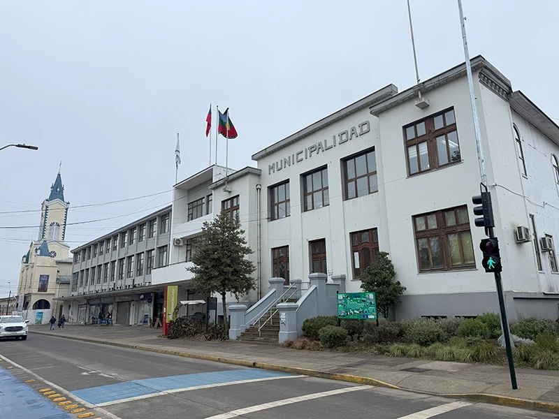

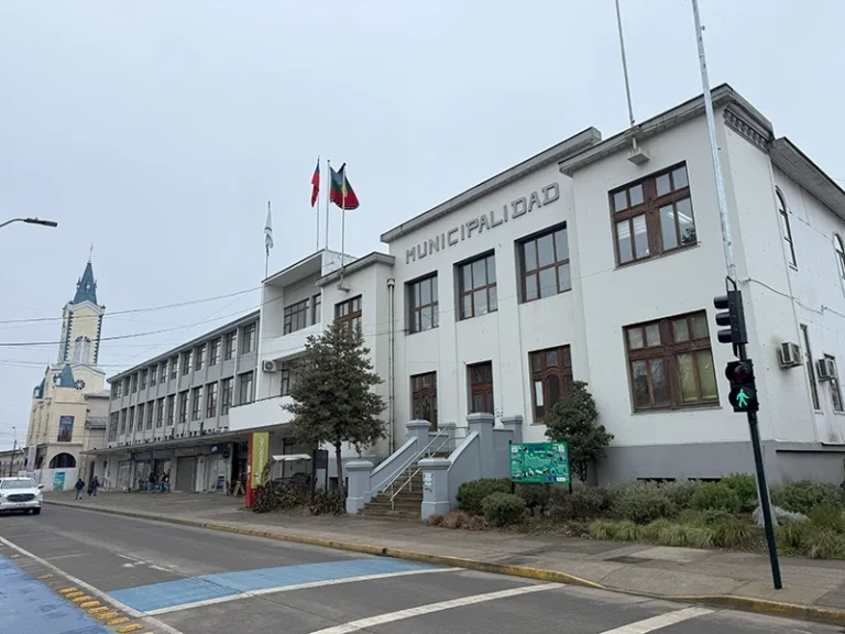
The Union is a municipality and provincial capital. He was elected head of the Ranco province when the Los Ríos region was created in 2007 (he became independent of Los Lagos). As the provincial capital, the provincial government of the Ranco, an organization dependent on the regional Intencia, operates in the city. The government finances and distributes resources to the municipalities of the province (La Unión, Futrón, Lago Ranco and Rio Bueno) and hosts the Provincial Governor’s office. In addition, the municipality has its local municipality: a mayor at the head (now Saturnino Quezada Solís) and a municipal council of six elected members.
Economy


The economic engine of The Union is the agricultural-livestock industry, taking advantage of its fertile valleys. The landscape of green meadows shows a strong dairy and livestock activity. In the Union is the parent house of COLUN (Agricultural and Milk Cooperative of the Union Ltda.), the largest dairy company in the country. Colun was founded in June 1949 by 70 small local dairy producers who joined to market their milk. Since then, the cooperative has grown to employ more than 2,000 workers throughout Chile. At present, COLUN brings together hundreds of partners and supplies of dairy at national and international level, and is a leading company in the Chilean dairy sector.
Bovine husbandry is also crucial: The Union is the largest producer of cattle in the region of Los Rios, making it an exporter of meat to domestic and international markets. In addition, the area’s fruit farming is oriented towards high-value added products: the commune stands out in the export of red cranberry, raspberry and other red fruits, thus providing raw material for national and regional industry. Another historical production pole is the Grob Mill, which has been operating for over 70 years, which produces flour for the market in southern Chile. In short, livestock, dairy and agriculture form the heart of the local economy, complemented by small industries such as flour mills and the production of sausages.
Culture and festivities
The Union has cultivated its own cultural identity and intangible heritage. Each year the municipality organizes the Milenario Alerce Festival, a folklore contest that encourages the musical creation inspired by local nature. There are also events such as the Union Film Week, a number of religious festivities, the association of traditional kitchens, a group of heritage guardians and cultural workers, among others. Among the illustrious characters linked to the commune are the naturalist Rodolfo Philippi (resident in the San Juan Fundo) and various pioneers of the dairy and livestock industry.
Architectural heritage
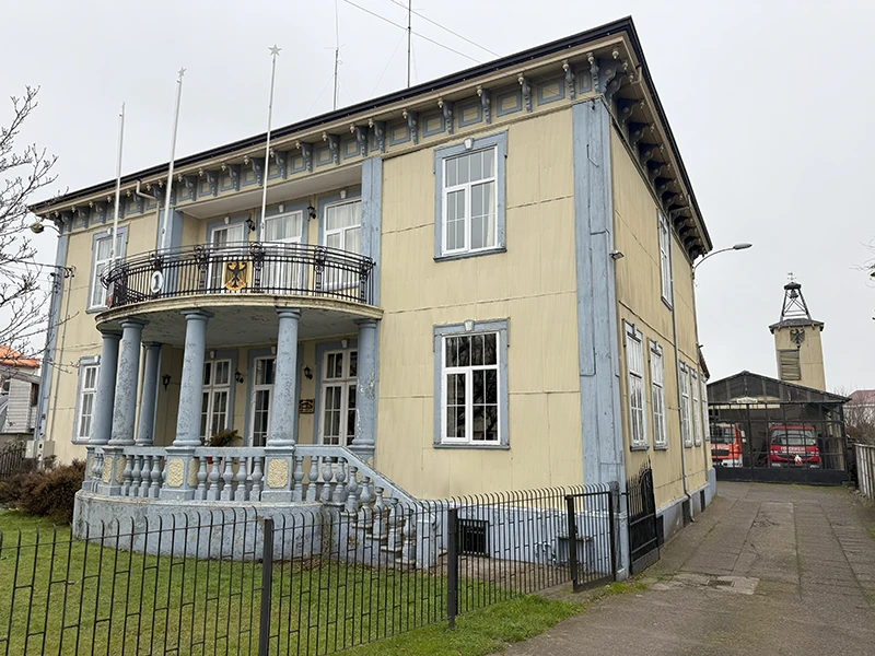
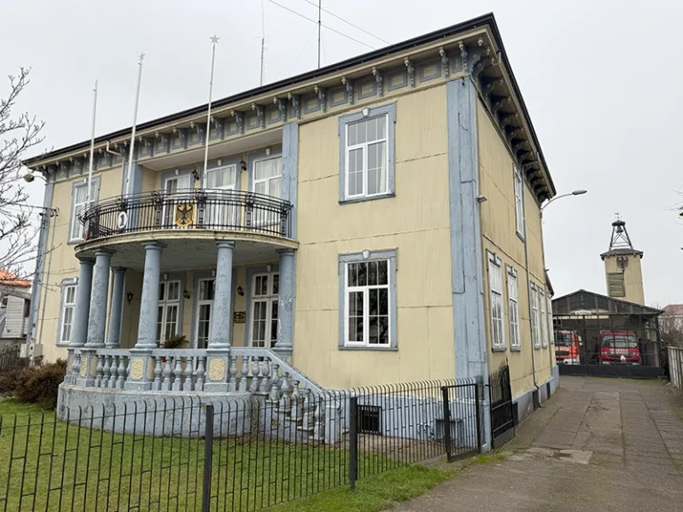
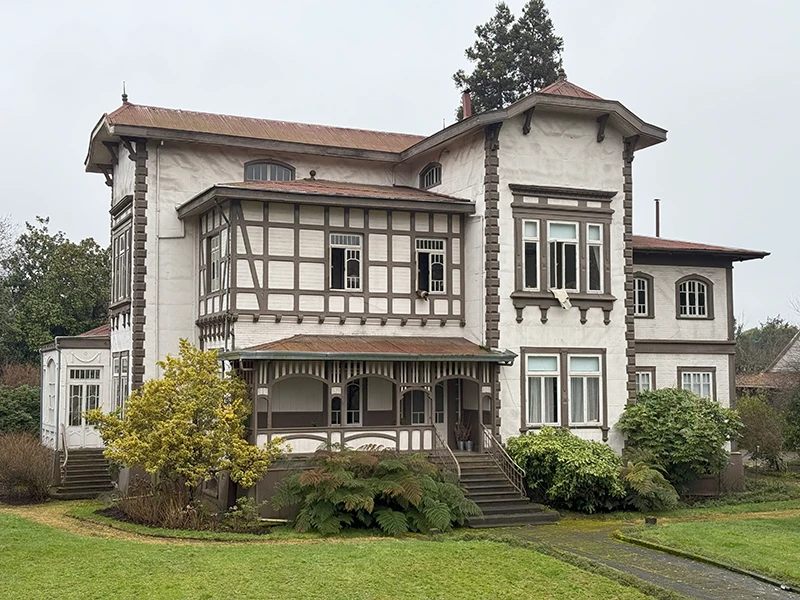
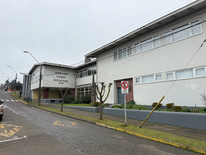
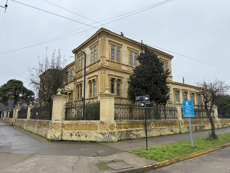
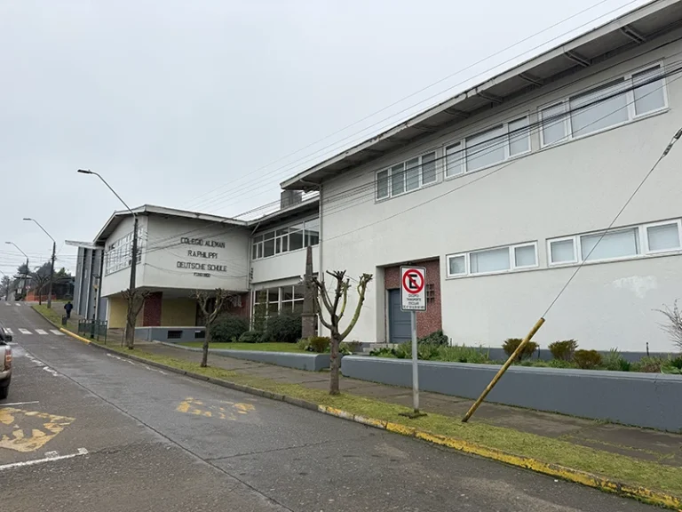
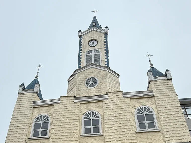
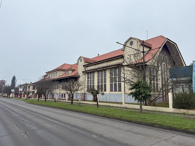
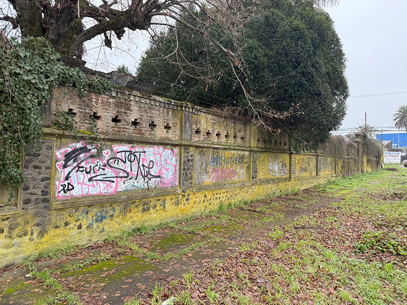
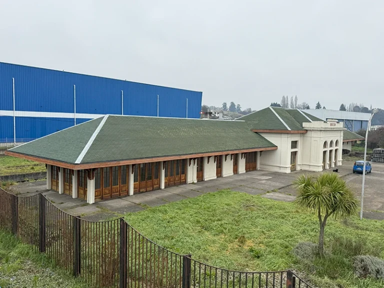
The German colonization of the mid-19th century left a legacy in the architecture of The Union. The urban heritage includes remarkable constructions from the late 19th and early 20th century. Among them are the Casa Grob (Francisco Bilbao Street, the Molino Grob, the Casa Duhalde (Manuel Montt with Serrano), the historic Germania Fire Headquarters, the Casa Hoppe (Letelier with Riquelme), the former Railway Station of The Union, the German College R.A. Philippi and the San José Parish located in the Plaza de la Concordia. These constructions have been declared a national heritage for their historical and aesthetic value; unfortunately, in 2016 the former Casa Iribarne (an additional copy) was demolished due to its state of deterioration.


Tourism and natural attractions
The Union offers many attractions for visitors, combining nature and heritage. The Alerce Costero National Park, which conserves millennia of alerce, such as the “Gran Abuelo” (“Gran Abuelo”), which attracts visitors interested in nature and botany, stands out.
Other natural landscapes include nearby beaches and rivers:
- Playa Colún (oceanic): large sandy beach of 9-10 km opposite the Pacific Ocean, with dunes and ancient coastal forests (olive trees) hit by the sea winds.
- Playa San Pedro (Lake Ranco): 9 km from Puerto Nuevo, ideal for outdoor recreation and water sports on the lake’s shore.
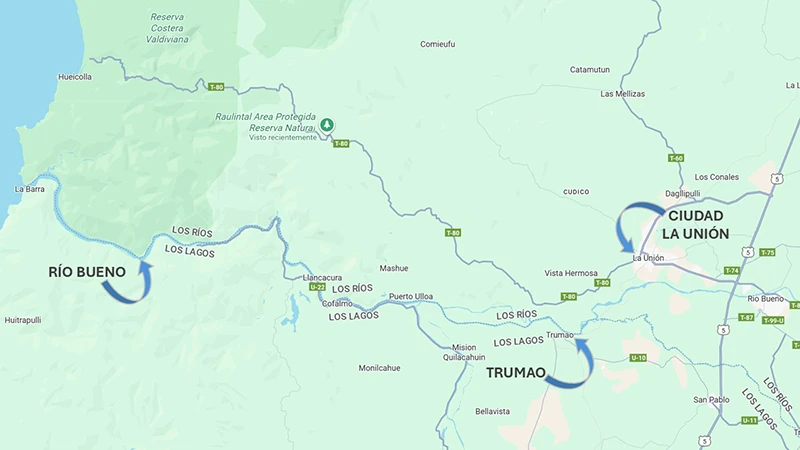
- Puerto Trumao (river Bueno): traditional raft boat; it is a starting point for river excursions and to visit the historic Trumao Mission, an 18th century wooden church built by Franciscan settlers.
- Playa de Puerto Nuevo (Lake Ranco): about 43 km on the south bank, it has sand enabled for bath; it stands out the old raft pass over the river Bueno and the coastal forest nearby.
- Church Mission of Trumao: a wooden temple founded at the end of the 18th century by Franciscan missionaries, a historical relic next to the port of Trumao.
- The Rulintal Protected Area: a private nature reserve of ~ 2,000 hectares located in the Cordillera de la Costa, with trails up to trails to millennial alerts adjacent to the Alerce Costero Park. With dense and high biodiversity, it stands out for its relict forests and unique specimens of flora and fauna.
River Trade and Transport in the River Good before and after the 1960 Earthquake
The Golden Age of River Trade in the River Bueno
During the 19th century and the first decades of the 20th century, the lower section of the Bueno River, especially between Trumao and the mouth in La Barra, was one of the main commercial routes in southern Chile. This river road connected communities producing the interior, such as Osorno, La Unión, Rio Bueno and San Pablo, with the seaports of Chiloé, Corral and Puerto Montt, and even with international routes to Europe.
The river port of Trumao, located a few kilometres from The Union, was consolidated as a strategic point in this network. There they attracted vapours and barges from the coast, which carried agricultural products and inland livestock. Among the most common goods were cereals (wheat, oats, barley), hides, wool, wood and lingue shells used in September.
Trumao also operated as a logistics centre with informal customs functions: the cargo was temporarily stored and then redistributed by two main routes:
- By land to places like Osorno.
- By rail from the Trumao station, connected to the longitudinal line that joined Valdivia, Osorno and Puerto Montt.
The presence of the train transformed Trumao into a key intermodal node, integrating river navigation, land and rail transport. At this stage of splendor, Trumao was considered a “symbol of trade progress” for the region.
Another relevant point was the Buen River Bar, where sea cabotage ships entered from the ocean to remount the river to Trumao. Although it was not a formal port, this mouth was vital to connect regional trade with coastal and ultra-marine traffic.


The 1960 Earthquake: The End of an Age
On May 22, 1960, the great Valdivia earthquake, the strongest in world history, changed the geography and economy of southern Chile forever. One of its least known, but deeply significant, effects was the collapse of river trade in the Good River.
After the earthquake and associated tsunami, the access channel to the river was deeply affected. The bottom of the river changed dramatically and sand banks formed that embed the course, especially at its mouth. This caused the impossibility of navigation for large-scale vessels, abruptly interrupting the river traffic to and from Trumao.
Neighbors of the time remember that merchant ships “that had previously arrived from Europe” stopped sailing the river because “the bottom of the channel changed by preventing its passage.” The episode marked the epílogo of the golden age of the river port: the direct connection between the sea and the agricultural interior was lost.
One of the last milestones of this time was the arrival of the Aspirante Isaza Navy barge in June 1960, sent to support the affected areas. His visit aroused curiosity, but also symbolized the closure of a cycle.
Geographical and Economic Impact
In addition to blocking navigation, the earthquake profoundly altered local geography. The accumulation of sediments on the well river bar permanently obstructed the maritime entrance, eliminating the possibility of recovering the river route for commercial freight transport.
Since then, the only possible navigation in the area was limited to the use of small boats and ferries, mainly for the crossing of persons or small volumes of goods within the Union commune.
The economic consequences were severe:
- Isolation of coastal communities, which lost their direct access to the sea.
- Increased transport costs by relying exclusively on trains or land routes (such as current Route 5).
- Disappeared from the traditional trade flow, which had been efficient and economic for decades.
As local historians point out, the 1960 earthquake put an end to the days of glory of river trade on the river Bueno, marking a before and a later in the economic connectivity of The Union and the entire Ranco province.
Discover the properties Produncan Lands has to offer you in The Union
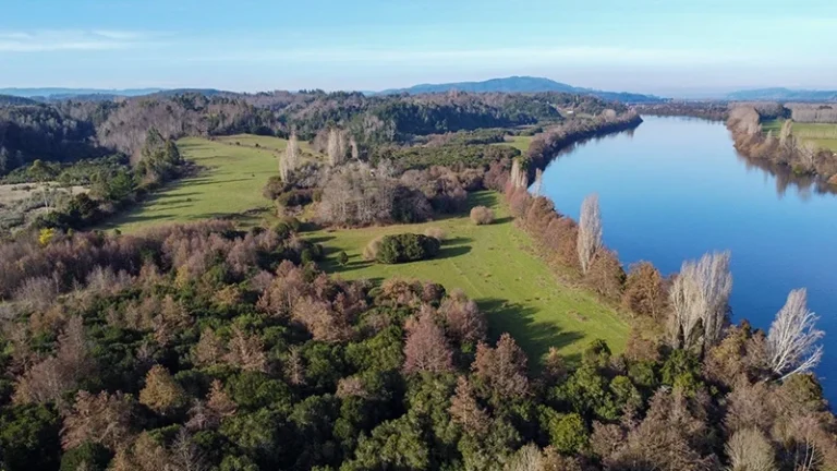
Lanchosce field


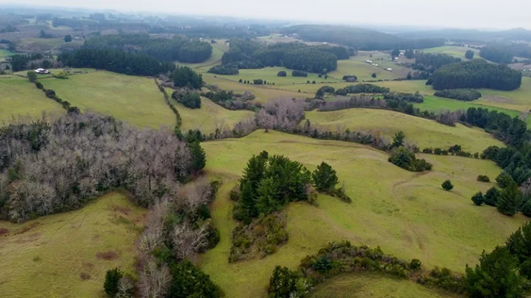
Agricola- livestock field 14 minutes from the centre of the Union, with direct access by asphalt road and no servitude. It has 70% meadows, the topography is wavy, panoramic views, slopes and mats.
Hotel Riquelme
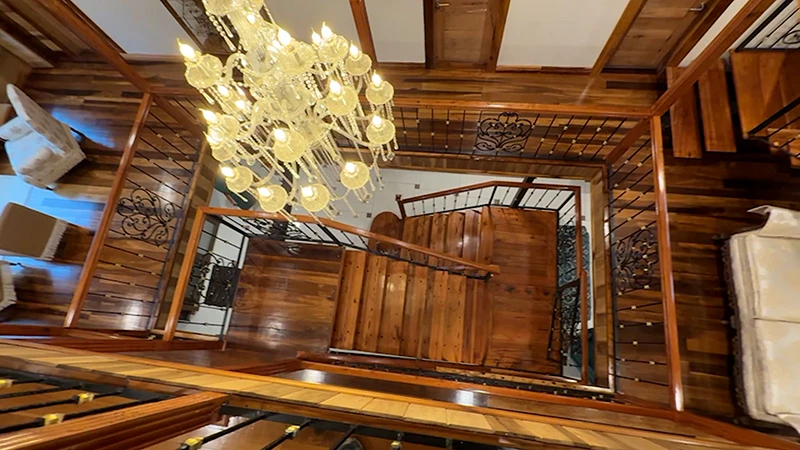


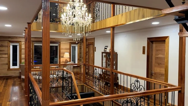
Hotel Boutique in La Unión. 875m ² useful on 3 floors, remodeled in 2018. 13 rooms en suite, 1 apartment, 2 living rooms, lift, all covered in native wood, forged iron rails. The best location.
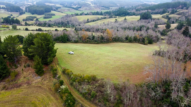
Beautiful View Field
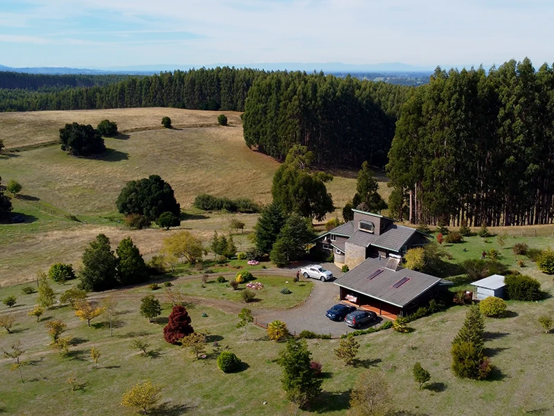


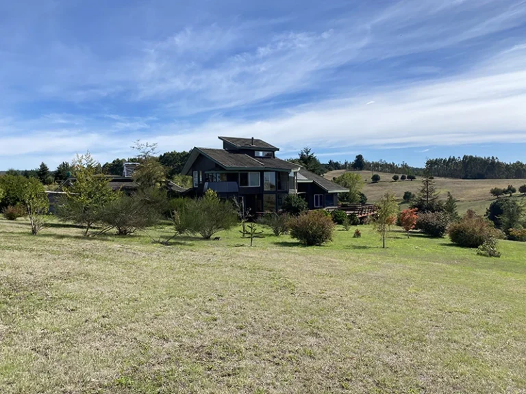
Country 10 minutes from the city of La Unión with modern house of 237m ², cabin, stable, caretaker house, drinking water, 2 norias registered in DGA, slopes, sotterrada electricity, fruit park and asphalt access. An additional 20 hectares can be acquired that hang with the property.
The Union: between the natural wealth of the south and the rise in rural investment
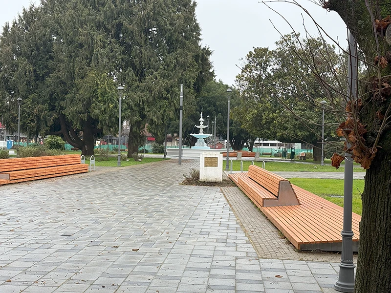
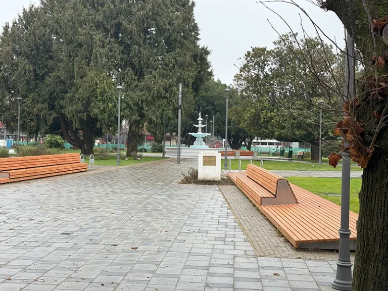
Together, the city of La Union and its surroundings combine natural-environment tourist attractions, such as mountains, native forests, caudalous rivers and lakes of glacial origin, with a valuable historical-cultural legacy visible in its streets, squares, old houses and museums. Its urban layout, influenced by German colonization, and the warmth of its people, create an authentic and welcoming environment for the visitor.
This territory is ideal not only for those who seek experiences linked to the southern nature and architectural heritage of Chile, but also for those interested in investment opportunities. Its agricultural-livestock development, supported by fertile soils, abundant water and road connectivity, positions the Union as a strategic pole for initiatives linked to agriculture, rural tourism, sustainable production and life in harmony with the environment.
Just minutes from destinations such as the Alerce Costero National Park or the mouth of the Bueno River, The Union represents a balanced fusion between tradition, scenic beauty and economic projection, increasingly recognized at regional and national level.